A wonderful excursion to discover the territory of Gambassi Terme, rich in history and nature.
You will start like the old pilgrims, walking along part of an ancient and famous medieval route, the Via Francigena. You will then immerse yourself in the dense heart of the vegetation and we will wade through streams to discover hypothermal springs, which have always been frequented by the local population due to their charm and attractiveness.
Accompanied by the unmistakable smell of sulphur, typical of these sulphurous waters and by the sounds of nature alone, you will encounter the ruins of ancient mills and medieval furnaces, you will go in search of the traces of one of the last hermits who found solace in the ravines and gorges characterize this fascinating part of the territory.
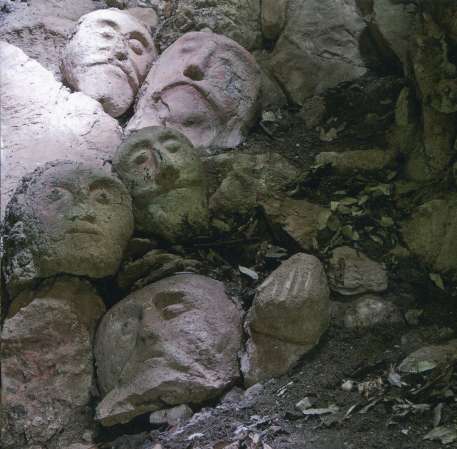
As new explorers you will discover waterfalls, remains of statues and the daily life of a man whose story cannot fail to fascinate.
An excursion that will leave you enraptured!
General information of the route
Where is it
When
Price
Duration
Path length
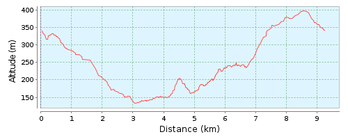
Overall height difference
Type of route
Technical level
Physical commitment
Minimum age
Activity suitable for over 65
Accessibility

| Minimum age | generally over 8 years old |
| Over 65 | Activities are generally suitable (always ask for confirmation before starting) |
| People with disabilities | I always try to find the solution to allow everyone to participate: no one excluded! |
| Languages | Italian English |
| Services included | organization and coordination of activities by a qualified Environmental Guide according to LR 86/2016 |
| Services excluded | anything not mentioned in the included services |
| Extra services on request | If possible, I always try to customize the activity to meet everyone's needs |
| Reservation and cancellation | Time limit for booking: 24 h beforeTime limit for cancellation: 24 h beforeConfirmation of reservation: the reservation is confirmed only upon payment, to be made according to the instructions sent at the time of the reservation |
| In case of rain | The Guide reserves the right to modify or cancel the excursion in the event of adverse weather conditions, risky situations and / or unforeseen events for the participants. |
| Important notes | the proposed activity is of simple accompaniment, therefore each participant is responsible for his / her own preparation and psycho-physical condition. the participants are able to carry out the proposed excursion. The guides are in possession of the RCT insurance required by law. The participants in the excursions are NOT covered by personal accident insurance. |
| When | Generally always: every season has its own charm |
| Duration | Depending on the route, it can vary from half a day to a full day. We are in no hurry, let's enjoy the experience |
| Meeting place | Depending on the route. It is agreed with customers in relation to individual needs. |
| Route type | Ring route: departure and arrival coincideOnline path: departure and arrival do not coincide |
| Path length | The length of a route is the distance between the starting point and the arrival point, calculated with the use of paper maps and GPS instruments, excluding in the calculation small deviations from the route for stops or for other reasons. The measure shown is indicative and is always expressed in kilometers (km) |
| Overall height difference | The overall difference in height can be positive or negative: the overall positive difference in height is the sum total of the ascents present along the route; overall negative altitude difference is the total sum of the descents along the route, both of which are calculated with the use of paper maps and GPS instruments. The measure shown is always indicative and is expressed in meters (m). |
| Technical level | Bass: itinerary on small roads, mule tracks and / or wide paths, even with dirt roads, but generally regular and without obstacles; it develops in the immediate vicinity of towns, tourist resorts and communication routes. It does not present particularly demanding ascents and / or descents.Medium: itinerary on paths, obvious and / or short tracks off the path, with terrain of various types and consistencies, even uneven, and also with the presence of small crossings of watercourses. It can present even demanding ascents and / or descents, although not particularly long.High: itinerary on paths, tracks and / or off the path, even demanding ones, with terrain of various kinds and consistencies, often bumpy and with obstacles; it may have exposed sections and / or watercourse crossings, which may require the utmost attention. It can present demanding and / or long ascents and / or descents. |
| Physical commitment | Minimum: does not require a particular physical commitment and / or preparation. The daily routes do not exceed 10 km in length and / or an overall positive and / or negative difference in height of 300 meters.Medium: requires a certain physical commitment and preparation. The daily routes do not exceed 19 km in length and / or an overall positive and / or negative altitude difference of 800 meters.High: requires physical commitment and preparation. The daily routes can be of various lengths and / or overall positive and / or negative height differences. |
| Equipment required | preferably high trekking shoes, trekking or anyway comfortable clothing (long pants are recommended), hat, backpack, water (at least 1 liter). |
| Recommended equipment | food, rain gear (waterproof jacket, backpack cover), gaiters, trekking poles, camera. |
